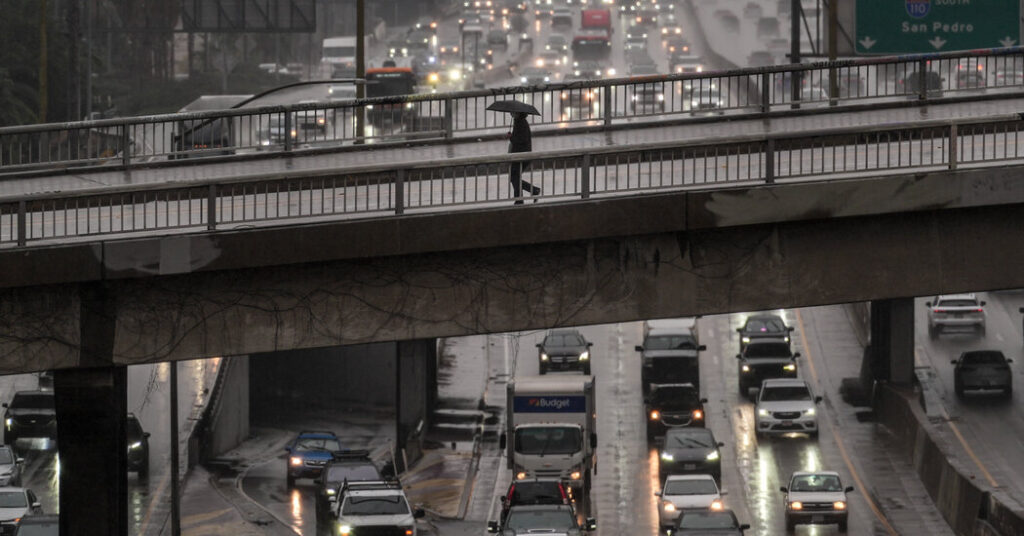
Some residents of Southern California were under evacuation warnings on Friday as an unusually strong storm system moved through the region, bringing with it a risk for flash flooding and landslides in areas recently burned by wildfires. The wet storm brought an initial soaking of rain earlier on Friday.
But the worst is yet to come. On Saturday, forecasters expect heavier rain to raise the risk of flash flooding as the system pulls in additional moisture off the Pacific Ocean.
“The atmosphere is going to be juicier on Saturday,” said Rich Thompson, a meteorologist with the National Weather Service office serving the Los Angeles area.
The Weather Service warned that the rain and strong winds will probably result in travel delays at airports, rockslides and mudslides on canyon roads, flooded roads, and swollen rivers and creeks. The weather could also potentially cause dangerous debris flows, a type of landslide that occurs when torrents of water and mud move down steep slopes.
Burn scars are especially prone to debris flows, and some Los Angeles County residents, including those in areas that were burned during the Palisades and Eaton fires in January, were under evacuation warnings until Sunday. (A warning means that people should be prepared to leave quickly.) Some parts of Ventura County were also under evacuation warnings, including in the area burned by the Mountain fire late last year.
The most severe weather will occur Saturday.
This system has two acts. The first occurred Thursday night into Friday afternoon, with Santa Barbara and Ventura Counties receiving a few inches of rain, and mostly light rain falling in the Los Angeles area.
Act 2 is expected to be more significant. It was to begin late Friday night and continue through Saturday, when the most severe weather is forecast. That includes heavy rain and potentially thunderstorms that could cause flooding.
Even on Friday morning, the exact details of Saturday’s forecast remained uncertain, as they have for much of this week. David Gomberg, a Weather Service meteorologist, said that the storm was pulling in a narrow band of moisture known as an atmospheric river off the Pacific Ocean. It was still unclear where that moisture would hit.
“We think it will set up somewhere between San Bernardino County and Ventura County,” Mr. Gomberg said.
It is unusual for meteorologists to have this much uncertainty about a storm’s path. Mr. Gomberg said that as Friday progressed, the storm’s geographic range was likely to shrink, with the moisture’s target becoming clearer.
How much rain is expected, and where.
Precipitation will probably fall across all of Southern California through Sunday, with snow in the mountains at elevations above 8,000 feet and rain falling from the inland deserts to the coast. The most precipitation is expected at the coast.
Santa Barbara County to Los Angeles County: Meteorologists said the highest rainfall totals were probable here, with three to four inches of rain in coastal and valley areas and four to eight inches in the mountains. Downtown Los Angeles could face three and a half to four inches of rain.
Thunderstorms could drop sudden bursts of especially heavy rain that would increase those totals in isolated spots, Mr. Thompson said.
In Los Angeles County, the heaviest rain is predicted to start before sunrise on Saturday morning and continue throughout the day.
Orange County to San Diego County: Rainfall totals are forecast to range from one and a half inches to three inches across coastal and valley areas and four to six inches in the mountains, with the highest totals likely in Orange and San Bernardino Counties and the lowest in San Diego County.
San Diego will see its heaviest rainfall early Saturday morning and in the afternoon, with the downtown area likely to record around two inches.
Thunderstorms could also bump up totals in some locations.
Why this storm is concerning.
The coastal mountains of Southern California, from the Santa Monica Mountains to the San Bernardino Mountains, are perfectly oriented to wring the moisture out of the atmospheric river and produce heavy rain.
“The moisture will hit those mountains dead on,” said Park Williams, a climate scientist at the University of California, Los Angeles. “Those mountains act as a wall, and the water slides down the mountains and then it goes into the city.”
In one chain of events, the heavy rain pouring down the mountains and into the urban areas will cause traffic delays on roads, scattered flash flooding, and minor mudslides and debris flows.
If the system aligns over Los Angeles County on Saturday and stalls over the region for a prolonged period of time, it could cause dangerous debris flows in the burn scars from the Palisades and Eaton fires and others from recent years.
Burn scars are susceptible to debris flows from heavy rain because wildfire flames have destroyed the vegetation and cooked the soil. The debris flows start as a flood that picks up sediment as it moves quickly across a hardened landscape without any vegetation to stop it.
Amy Graff is a Times reporter covering weather, wildfires and earthquakes.
The post The Heaviest Rain Is Yet to Come for Southern Californians Facing a Very Wet Storm appeared first on New York Times.