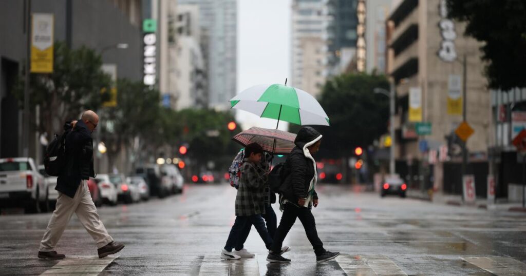
Southern California will be under a severe weather threat Saturday, with the most powerful wave of an incoming atmospheric river storm peaking over the weekend in Los Angeles County and bringing a risk of mudflows, debris flows and, possibly, a tornado.
If rain falls as forecast, this storm could result in downtown Los Angeles seeing its wettest November since 1985. Heavy rain brings the possibility of damaging flooding and landslides, with fire-scarred hillsides from the Eaton and Palisades fires at risk of fast-moving flows of mud and debris.
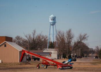
The storm moved in Friday, with scattered showers that will be a preview for the weekend. Some of the biggest concerns are in area burned by the January wildfires.
Near Rubio Canyon Trail in Altadena, plots where homes once stood soak up the rainfall.
Plastic tarps, netting and sandbags suspended by rope are affixed to steep hills on Stonehill Drive. A pyramid of sandbags sits at the bottom.
Nearby, construction workers have placed tarps over damaged or partial roofs to seal a surviving home off from the weather.
“We put these up back a couple months ago when there was a little rain,” one worker said. “We’re still doing some roofing work, so we think water is might still get in.”
Sharon Gray owns Eaton Dam Stables, just a few hundred feet from the ignition point in the canyon.
When the fire raced through in January, her horse boarding business and the trailer she lived in were decimated. Despite the chaos, she and a small group reacted quickly, saving all 39 horses in Eaton Canyon.
As for the weather, she’s not as worried as other residents further uphill.
“I don’t have any issue with what comes off the hills. We didn’t have issues with the rainstorm that came a couple months back.”
“We’re just doing what we can,” she said. “Nothing looks like it wants to slough off New York drive, and they have those road barriers up still. We seem to be able handle rain. People in Altadena got evacuation warnings, so they’re more worried about it.”
Friday’s storms also shut down a pair of Southern California amusement parks.
According to the park websites for Knott’s Berry Farm and Six Flags Magic Mountain, both parks were closed Friday “due to inclement weather.”
Customers with Friday tickets are eligible to use them on any other day the park is open through the rest of the year, according to the websites.
The severe weather threat is expected for much of Saturday, from midnight through 9 p.m. A flood watch will be in effect for a wide swath of Southern California from 4 a.m. to 10 p.m. Saturday. Evacuation warnings are in effect through 11 a.m. Sunday in areas near recent burn scars due to the risk of mud and debris flows. The warnings encompass areas near the Palisades, Eaton, Kenneth, Sunset and Hurst fires that burned in January.
But it remained unclear as of late Thursday which areas would be hit hardest by the storm. Peak rainfall rates Saturday of 0.75 to 1.25 inches per hour are expected along a relatively narrow band of land — about the width of a Southern California county. That’s enough rain to trigger a landslide, which can occur when rain falls at a rate of half an inch or more per hour.
Forecasters don’t yet know where that peak rain will be focused.
“The problem is, we just don’t know exactly which county” will be most affected, said Ryan Kittell, meteorologist with the National Weather Service office in Oxnard. “If you look at all of our projections, some of them favor L.A., some of them favor Ventura, some of them favor Santa Barbara County. And so at this point, unfortunately, for that Saturday time period, we just can’t tell with certainty which county is kind of in the bull’s-eye.”
If the band of most intense rain lines up over L.A. County, it can expect rainfall rates of about 1 inch per hour, Kittell said. If the band is concentrated elsewhere, L.A. could still see a rate of half an inch per hour, and landslides would still remain a possibility.
The area with the most severe weather could see spinning thunderstorms that could produce damaging wind or a tornado or two, Kittell said.
“While 99% of the area will not see such conditions, any portion of our area, especially in the coastal and valley areas, could see it,” Kittell said. “Consider changing any plans that you might have for Saturday. Stay home and indoors.”
In case of lightning, he noted that it’s best to stay inside and away from windows. Those who must go out should never attempt to drive through a flooded roadway.
There’s still a chance that Saturday’s storm could be less impressive than expected. It is being powered by a “cut-off low,” which is so notoriously difficult to forecast that it’s referred to as “weatherman’s woe.” Because the low-pressure system powering the storm is not pushed along by the jet stream, “it will just spin around like a top and go where it pleases — very difficult to predict,” Kittell said.
Still, Kittell said, most of the more than 100 different computer forecast projections suggest moderate to heavy rain. In the most likely scenario, downtown L.A. will receive 2.62 inches of rain between late Thursday and Sunday, which would cause flooding on roadways and minor, shallow debris flows.
Getting that 2.62 inches of rain through the weekend would vault this month into the category of wettest November since 1985, Kittell said. Downtown L.A. would need to exceed 2.43 inches of rain in November to break that 40-year-old record.
There’s a 30% chance of a worst-case scenario where downtown L.A. receives 4.81 inches of rain, producing mudflows and debris flows. With debris flows, the fast-moving landslides pour down hillsides and pick up not just mud but other debris that can move cars and crash into homes with deadly force. A total of 4.81 inches of rain would be one-third of downtown’s annual rainfall.
Both mudflows and debris flows can be triggered with rain falling at a rate as low as half an inch per hour. But it depends on the burn scar, Kittell said. It would take rain falling at twice that rate — an inch per hour — to trigger flows in some burn scars, he said.
The National Weather Service office in Oxnard said that on Saturday there’s about a 70% chance that the Eaton and Palisades fire burn scars will see rain fall at a rate of 0.5 inches or more per hour. There’s a 38% chance of a rainfall rate of 1 inch or more per hour in those areas.
Rain is expected to start falling by Friday morning in Los Angeles, Orange, Riverside, San Bernardino and San Diego counties. Precipitation was forecast to begin Thursday in Ventura, Santa Barbara and San Luis Obispo counties.
The heaviest rain for Southern California is expected late Friday into Saturday.
Although tornadoes aren’t usually associated with California, they do happen. For the most part, “they’re weak, they’re brief, and usually don’t cause a whole lot of issues,” Kittell said. “But we do get quite a few of them.” Sometimes they form on land, or they begin as waterspouts — a tornado over the ocean — and move onto land.
“They are not like the kind that you typically hear about in the Midwest that last for 15, 30 minutes, or even an hour or two, and are a mile or two wide and cause destructive damage,” Kittell said. “We just don’t have the environment for that,” yet they still pose a threat.
A tornado lasting for five minutes touched down in Santa Cruz County last December, injuring three people, downing trees and power poles, stripping trees of branches, overturning vehicles and damaging street signs.
This weekend’s atmospheric-river-powered storm created a long band of rainfall that on Thursday was stretching across the Pacific Ocean to San Francisco. It was set to move south and east as it headed to Southern California.
The storm downed trees in the San Francisco Bay Area on Thursday and flooded low-lying streets. A tree split and fell in San Francisco’s Western Addition neighborhood, crashing onto a vehicle, local news outlets reported. A tree also fell on a fence in Santa Rosa. Rising waters inundated a section of roadway just west of the Charles M. Schulz-Sonoma County Airport, firefighters said.
Solo vehicle crashes were reported on Highway 1 in Santa Cruz County, the California Highway Patrol said. A pickup truck overturned along Highway 152 between Watsonville and Gilroy, and all lanes of Highway 17 connecting Santa Cruz and San Jose were shut down for some time Thursday night following a crash involving a CHP cruiser; a CHP officer sustained minor injuries.
The post Storm slams Southern California as record-breaking rain possible this weekend appeared first on Los Angeles Times.